
Walnut Shade topographic map
Interactive map
Click on the map to display elevation.
About this map
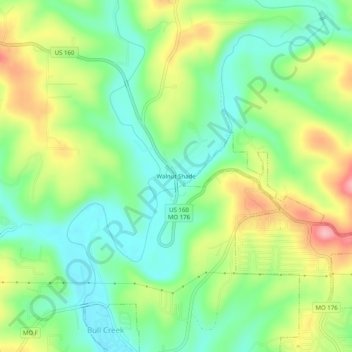
Name: Walnut Shade topographic map, elevation, terrain.
Location: Walnut Shade, Taney County, Missouri, 65740, United States (36.71256 -93.21351 36.75256 -93.17351)
Average elevation: 886 ft
Minimum elevation: 702 ft
Maximum elevation: 1,188 ft