
Machachi topographic map
Interactive map
Click on the map to display elevation.
About this map
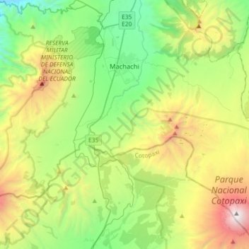
Name: Machachi topographic map, elevation, terrain.
Location: Machachi, Mejía, Pichincha, Ecuador (-0.72106 -78.60579 -0.43621 -78.32060)
Average elevation: 11,624 ft
Minimum elevation: 7,871 ft
Maximum elevation: 19,216 ft