
Old Brampton topographic map
Interactive map
Click on the map to display elevation.
About this map
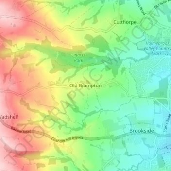
Name: Old Brampton topographic map, elevation, terrain.
Average elevation: 594 ft
Minimum elevation: 328 ft
Maximum elevation: 988 ft
Other topographic maps
Click on a map to view its topography, its elevation and its terrain.
Tupton
United Kingdom > England > Derbyshire > North East Derbyshire
Tupton, North East Derbyshire, Derbyshire, England, United Kingdom
Average elevation: 397 ft
Clay Cross CP
United Kingdom > England > Derbyshire > North East Derbyshire
Clay Cross CP, North East Derbyshire, Derbyshire, England, United Kingdom
Average elevation: 436 ft