
Debrecen topographic map
Interactive map
Click on the map to display elevation.
About this map
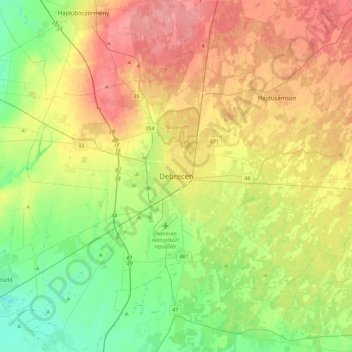
Name: Debrecen topographic map, elevation, terrain.
Average elevation: 394 ft
Minimum elevation: 285 ft
Maximum elevation: 528 ft
Other topographic maps
Click on a map to view its topography, its elevation and its terrain.
Debrecen
Hungary > Hajdú-Bihar > Debrecen
Debrecen, Debreceni járás, Hajdú-Bihar, Great Plain and North, 4000, Hungary
Average elevation: 390 ft