
Isle topographic map
Interactive map
Click on the map to display elevation.
About this map
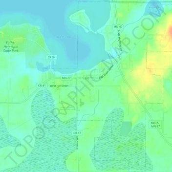
Name: Isle topographic map, elevation, terrain.
Location: Isle, Mille Lacs County, Minnesota, United States (46.11839 -93.48390 46.15420 -93.43197)
Average elevation: 1,273 ft
Minimum elevation: 1,237 ft
Maximum elevation: 1,355 ft