
Tepeören Mahallesi topographic map
Interactive map
Click on the map to display elevation.
About this map
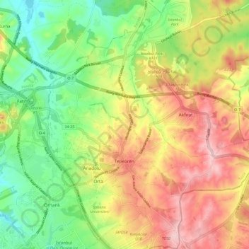
Name: Tepeören Mahallesi topographic map, elevation, terrain.
Location: Tepeören Mahallesi, Tuzla, Istanbul, Marmara Region, Turkey (40.87902 29.35484 40.96452 29.45620)
Average elevation: 499 ft
Minimum elevation: 177 ft
Maximum elevation: 863 ft