
Tito topographic map
Interactive map
Click on the map to display elevation.
About this map
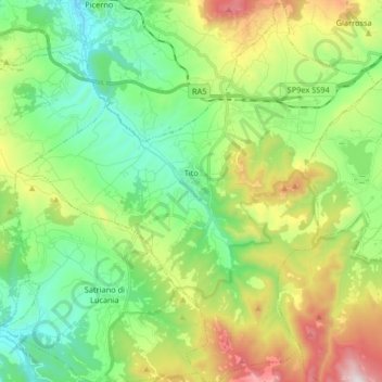
Name: Tito topographic map, elevation, terrain.
Location: Tito, PZ, Basilicata, 85050, Italy (40.51552 15.59289 40.63996 15.75473)
Average elevation: 2,664 ft
Minimum elevation: 1,483 ft
Maximum elevation: 5,112 ft