
Riós topographic map
Interactive map
Click on the map to display elevation.
About this map
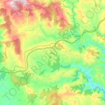
Name: Riós topographic map, elevation, terrain.
Location: Riós, Ourense, Galicia, Spain (41.91179 -7.35533 42.03887 -7.17348)
Average elevation: 2,710 ft
Minimum elevation: 1,759 ft
Maximum elevation: 4,177 ft