
Porciles topographic map
Interactive map
Click on the map to display elevation.
About this map
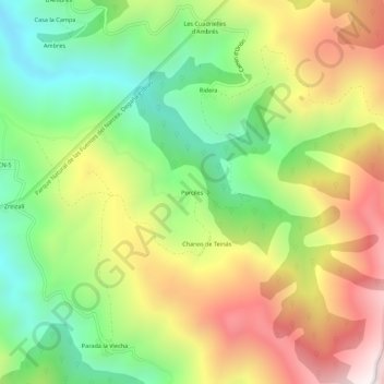
Name: Porciles topographic map, elevation, terrain.
Location: Porciles, Asturias, España (43.13733 -6.42198 43.17733 -6.38198)
Average elevation: 3,474 ft
Minimum elevation: 1,923 ft
Maximum elevation: 5,440 ft
Other topographic maps
Click on a map to view its topography, its elevation and its terrain.