
Shaqra topographic map
Interactive map
Click on the map to display elevation.
About this map
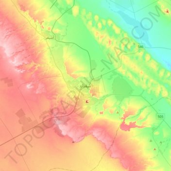
Name: Shaqra topographic map, elevation, terrain.
Location: Shaqra, Riyadh Region, 15571 - 8925, Saudi Arabia (25.08833 45.09278 25.40833 45.41278)
Average elevation: 2,408 ft
Minimum elevation: 2,123 ft
Maximum elevation: 2,743 ft
Other topographic maps
Click on a map to view its topography, its elevation and its terrain.
Jibal Tuwayq
Jibal Tuwayq, Shaqra, Riyadh Region, Saudi Arabia
Average elevation: 2,448 ft