
Far Oakridge topographic map
Interactive map
Click on the map to display elevation.
About this map
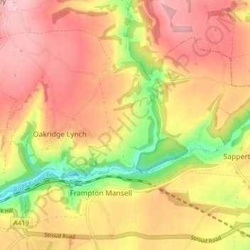
Name: Far Oakridge topographic map, elevation, terrain.
Average elevation: 591 ft
Minimum elevation: 269 ft
Maximum elevation: 804 ft
Other topographic maps
Click on a map to view its topography, its elevation and its terrain.
Bournes Green
United Kingdom > England > Gloucestershire > Stroud > Oakridge Lynch
Bournes Green, Bisley-with-Lypiatt, Oakridge Lynch, Stroud, Gloucestershire, England, GL6 7NL, United Kingdom
Average elevation: 607 ft