
Białystok topographic map
Interactive map
Click on the map to display elevation.
About this map
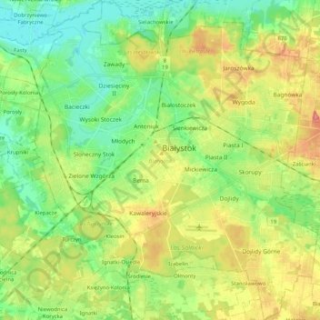
Name: Białystok topographic map, elevation, terrain.
Location: Białystok, Podlaskie Voivodeship, Poland (53.06660 23.06579 53.18860 23.24719)
Average elevation: 466 ft
Minimum elevation: 361 ft
Maximum elevation: 623 ft
Other topographic maps
Click on a map to view its topography, its elevation and its terrain.
Piaski
Poland > Podlaskie Voivodeship > Białystok
Piaski, Białystok, Podlaskie Voivodeship, Poland
Average elevation: 479 ft