
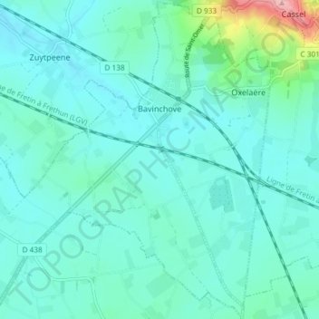
Bavinkhove topographic map
Interactive map
Click on the map to display elevation.
About this map
Name: Bavinkhove topographic map, elevation, terrain.
Average elevation: 148 ft
Minimum elevation: 72 ft
Maximum elevation: 564 ft
Bavinkhove ligt in het Houtland, op een hoogte van 15-93 meter. In het noorden ligt de Kasselberg, een getuigenheuvel op de westelijke uitloper van het West-Vlaams Heuvelland.