
Igatpuri topographic map
Interactive map
Click on the map to display elevation.
About this map
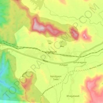
Name: Igatpuri topographic map, elevation, terrain.
Location: Igatpuri, Nashik, Maharashtra, India (19.65525 73.52514 19.73525 73.60514)
Average elevation: 1,969 ft
Minimum elevation: 879 ft
Maximum elevation: 3,192 ft