
Tipong;Lekhapani topographic map
Interactive map
Click on the map to display elevation.
About this map
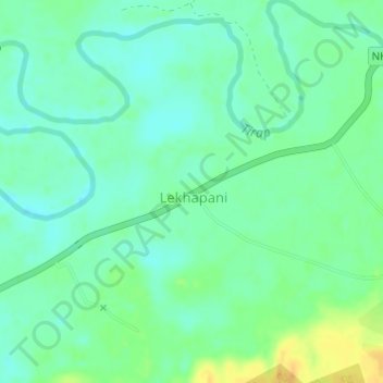
Name: Tipong;Lekhapani topographic map, elevation, terrain.
Location: Tipong;Lekhapani, NH315, Tipong, Kamba, Tinsukia, Assam, India (27.32729 95.83446 27.32739 95.83456)
Average elevation: 495 ft
Minimum elevation: 459 ft
Maximum elevation: 558 ft