
Buffalo Springs topographic map
Interactive map
Click on the map to display elevation.
About this map
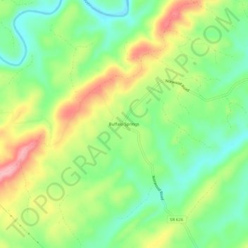
Name: Buffalo Springs topographic map, elevation, terrain.
Location: Buffalo Springs, Nelson County, Virginia, 24553, USA (37.58959 -78.88196 37.62959 -78.84196)
Average elevation: 584 ft
Minimum elevation: 390 ft
Maximum elevation: 860 ft