
El Rodadero topographic map
Interactive map
Click on the map to display elevation.
About this map
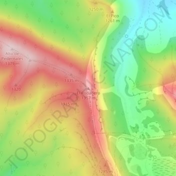
Name: El Rodadero topographic map, elevation, terrain.
Location: El Rodadero, Contreras, Burgos, Castile and León, 09610, Spain (42.00033 -3.41925 42.00043 -3.41915)
Average elevation: 3,963 ft
Minimum elevation: 3,415 ft
Maximum elevation: 4,524 ft