
Libreville topographic map
Interactive map
Click on the map to display elevation.
About this map
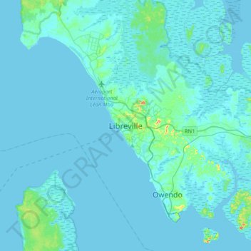
Name: Libreville topographic map, elevation, terrain.
Location: Libreville, Estuaire, 571, Gabon (0.23000 9.29400 0.55000 9.61400)
Average elevation: 20 ft
Minimum elevation: -10 ft
Maximum elevation: 361 ft