
Thiensville topographic map
Interactive map
Click on the map to display elevation.
About this map
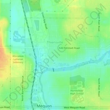
Name: Thiensville topographic map, elevation, terrain.
Location: Thiensville, Ozaukee County, Wisconsin, USA (43.22527 -87.98896 43.24352 -87.96382)
Average elevation: 692 ft
Minimum elevation: 646 ft
Maximum elevation: 758 ft