
Learmonth topographic map
Interactive map
Click on the map to display elevation.
About this map
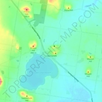
Name: Learmonth topographic map, elevation, terrain.
Location: Learmonth, City of Ballarat, Victoria, Australia (-37.45478 143.68433 -37.38546 143.76017)
Average elevation: 1,394 ft
Minimum elevation: 1,302 ft
Maximum elevation: 1,765 ft
Other topographic maps
Click on a map to view its topography, its elevation and its terrain.
Selwood Hill
Australia > Victoria > Learmonth
Selwood Hill, Learmonth, City of Ballarat, Victoria, Australia
Average elevation: 1,375 ft