
Brøndby Municipality topographic map
Interactive map
Click on the map to display elevation.
About this map
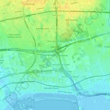
Name: Brøndby Municipality topographic map, elevation, terrain.
Average elevation: 26 ft
Minimum elevation: -13 ft
Maximum elevation: 79 ft
Other topographic maps
Click on a map to view its topography, its elevation and its terrain.
Øresund
Denmark > Capital Region of Denmark > Copenhagen
Øresund, Copenhagen, Copenhagen Municipality, Capital Region of Denmark, 3150, Denmark
Average elevation: 82 ft