
Tung Chung topographic map
Interactive map
Click on the map to display elevation.
About this map
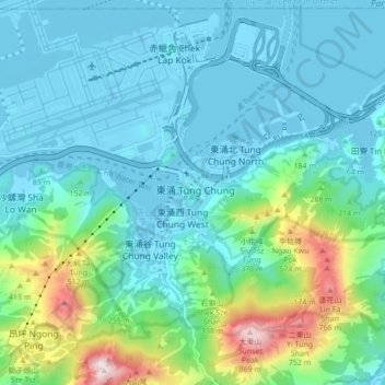
Name: Tung Chung topographic map, elevation, terrain.
Location: Tung Chung, Islands District, Hong Kong, PRC (22.24621 113.89991 22.32621 113.97991)
Average elevation: 551 ft
Minimum elevation: -52 ft
Maximum elevation: 2,904 ft