
山东 topographic map
Interactive map
Click on the map to display elevation.
About this map
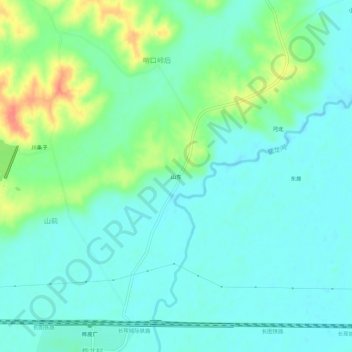
Name: 山东 topographic map, elevation, terrain.
Location: 山东, Changyi District, Jilin City, Jilin, PRC (43.99126 126.21893 44.03126 126.25893)
Average elevation: 630 ft
Minimum elevation: 584 ft
Maximum elevation: 751 ft