
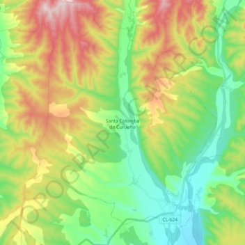
Santa Colomba de Curueño topographic map
Interactive map
Click on the map to display elevation.
About this map
Name: Santa Colomba de Curueño topographic map, elevation, terrain.
Location: Santa Colomba de Curueño, León, Castile and León, Spain (42.68672 -5.47588 42.81685 -5.34397)
Average elevation: 3,350 ft
Minimum elevation: 2,815 ft
Maximum elevation: 4,259 ft