
Žabljek topographic map
Interactive map
Click on the map to display elevation.
About this map
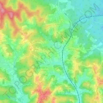
Name: Žabljek topographic map, elevation, terrain.
Location: Žabljek, Slovenska Bistrica, 2318, Slovenia (46.32832 15.53883 46.36832 15.57883)
Average elevation: 965 ft
Minimum elevation: 830 ft
Maximum elevation: 1,165 ft