
Chateauguay topographic map
Interactive map
Click on the map to display elevation.
About this map
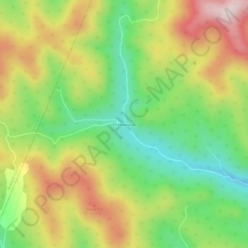
Name: Chateauguay topographic map, elevation, terrain.
Location: Chateauguay, Windsor County, Vermont, USA (43.64035 -72.71482 43.68035 -72.67482)
Average elevation: 1,955 ft
Minimum elevation: 1,283 ft
Maximum elevation: 2,792 ft