
Ambatofotsy topographic map
Interactive map
Click on the map to display elevation.
About this map
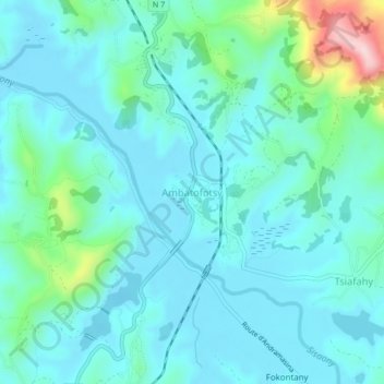
Name: Ambatofotsy topographic map, elevation, terrain.
Location: Ambatofotsy, Analamanga, Province d’Antananarivo, Madagascar (-19.08896 47.53072 -19.04896 47.57072)
Average elevation: 4,314 ft
Minimum elevation: 4,144 ft
Maximum elevation: 5,151 ft