
Lagro topographic map
Interactive map
Click on the map to display elevation.
About this map
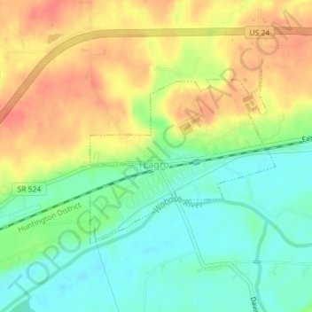
Name: Lagro topographic map, elevation, terrain.
Location: Lagro, Wabash County, Indiana, United States (40.83120 -85.73783 40.84646 -85.71658)
Average elevation: 745 ft
Minimum elevation: 659 ft
Maximum elevation: 833 ft
Other topographic maps
Click on a map to view its topography, its elevation and its terrain.
Wabash
United States > Indiana > Wabash County
Wabash, Wabash County, Indiana, 46992, United States
Average elevation: 764 ft
North Manchester
United States > Indiana > Wabash County
North Manchester, Wabash County, Indiana, 46962, United States
Average elevation: 778 ft
Sunnymede
United States > Indiana > Wabash County > Wabash > Sunnymede
Sunnymede, Wabash, Wabash County, Indiana, 46992, United States
Average elevation: 755 ft