
Guskara topographic map
Interactive map
Click on the map to display elevation.
About this map
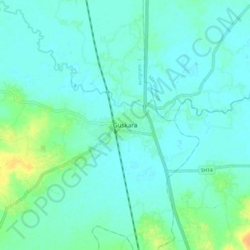
Name: Guskara topographic map, elevation, terrain.
Average elevation: 115 ft
Minimum elevation: 95 ft
Maximum elevation: 184 ft
Guskara is located at 23°30′N 87°45′E / 23.50°N 87.75°E / 23.50; 87.75. It has an average elevation of 38 metres (125 feet). Guskara is located in the alluvial flood plains of several rivers. Kunur River flows past it.