
Mihara topographic map
Interactive map
Click on the map to display elevation.
About this map
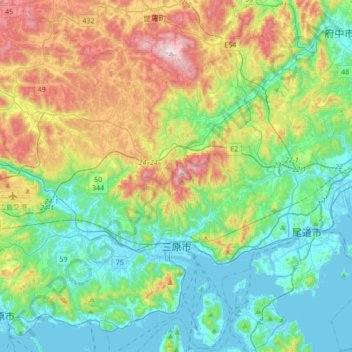
Name: Mihara topographic map, elevation, terrain.
Location: Mihara, Hiroshima Prefecture, Japan (34.30384 132.84740 34.59367 133.16249)
Average elevation: 640 ft
Minimum elevation: -10 ft
Maximum elevation: 2,238 ft