
La Plata topographic map
Interactive map
Click on the map to display elevation.
About this map
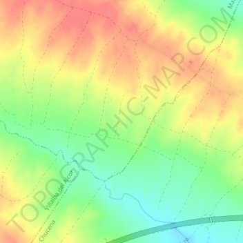
Name: La Plata topographic map, elevation, terrain.
Location: La Plata, Manzanilla, El Condado, Huelva, Andalusia, Spain (37.35369 -6.42429 37.37369 -6.40429)
Average elevation: 433 ft
Minimum elevation: 331 ft
Maximum elevation: 518 ft