
Dharamkot topographic map
Interactive map
Click on the map to display elevation.
About this map
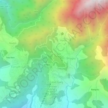
Name: Dharamkot topographic map, elevation, terrain.
Average elevation: 6,227 ft
Minimum elevation: 4,259 ft
Maximum elevation: 9,800 ft
Other topographic maps
Click on a map to view its topography, its elevation and its terrain.
Sarah
India > Himachal Pradesh > Dharamshala
Sarah, Dharamshala, Kangra, Himachal Pradesh, 176209, India
Average elevation: 2,953 ft
Dharamshala
India > Himachal Pradesh > Dharamshala
Dharamshala, Kangra District, Himachal Pradesh, 176200, India
Average elevation: 5,843 ft