
Gerede topographic map
Interactive map
Click on the map to display elevation.
About this map
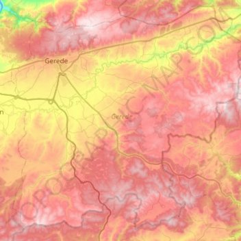
Name: Gerede topographic map, elevation, terrain.
Location: Gerede, Bolu, Black Sea Region, Turkey (40.53024 32.10935 40.88265 32.59575)
Average elevation: 4,633 ft
Minimum elevation: 2,306 ft
Maximum elevation: 6,342 ft
Other topographic maps
Click on a map to view its topography, its elevation and its terrain.
Artvin
Turkey > Black Sea Region > Artvin
Artvin, Artvin Merkez, Artvin, Black Sea Region, 08000, Turkey
Average elevation: 4,308 ft