
Mills River topographic map
Interactive map
Click on the map to display elevation.
About this map
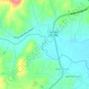
Name: Mills River topographic map, elevation, terrain.
Location: Mills River, Henderson County, North Carolina, 28759, USA (35.39328 -82.57457 35.39853 -82.57253)
Average elevation: 2,142 ft
Minimum elevation: 2,051 ft
Maximum elevation: 2,402 ft