
Birkkarspitze topographic map
Interactive map
Click on the map to display elevation.
About this map
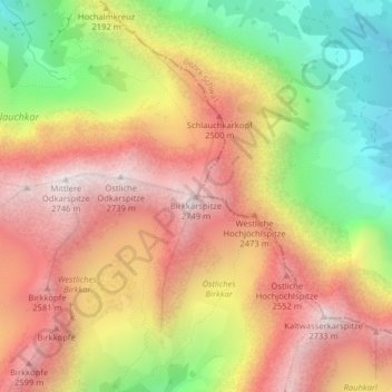
Name: Birkkarspitze topographic map, elevation, terrain.
Location: Birkkarspitze, Scharnitz, Innsbruck-Land, Tirol, Österreich (47.41124 11.43760 47.41134 11.43770)
Average elevation: 7,165 ft
Minimum elevation: 5,036 ft
Maximum elevation: 8,927 ft