
Friedrichsdorf topographic map
Interactive map
Click on the map to display elevation.
About this map
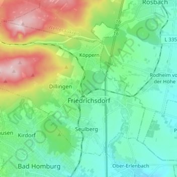
Name: Friedrichsdorf topographic map, elevation, terrain.
Location: Friedrichsdorf, Hochtaunuskreis, Hesse, 61381, Germany (50.23129 8.56877 50.29026 8.68992)
Average elevation: 741 ft
Minimum elevation: 443 ft
Maximum elevation: 1,529 ft