
Adachi topographic map
Interactive map
Click on the map to display elevation.
About this map
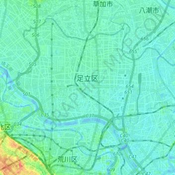
Name: Adachi topographic map, elevation, terrain.
Location: Adachi, Tokyo, Kanto, Japan (35.73866 139.73569 35.81748 139.85870)
Average elevation: 20 ft
Minimum elevation: -16 ft
Maximum elevation: 125 ft
Other topographic maps
Click on a map to view its topography, its elevation and its terrain.