
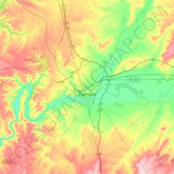
Zamora topographic map
Interactive map
Click on the map to display elevation.
About this map
Name: Zamora topographic map, elevation, terrain.
Location: Zamora, Castile and León, Spain (41.45850 -5.97753 41.57416 -5.63534)
Average elevation: 2,274 ft
Minimum elevation: 1,975 ft
Maximum elevation: 2,657 ft