
Sadsburyville topographic map
Interactive map
Click on the map to display elevation.
About this map
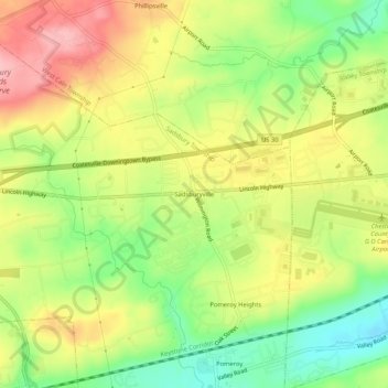
Name: Sadsburyville topographic map, elevation, terrain.
Average elevation: 627 ft
Minimum elevation: 404 ft
Maximum elevation: 850 ft
Other topographic maps
Click on a map to view its topography, its elevation and its terrain.
Pomeroy
United States > Pennsylvania > Chester County > Sadsbury Township
Pomeroy, Sadsbury Township, Chester County, Pennsylvania, 19367, United States
Average elevation: 574 ft