
Buhler topographic map
Interactive map
Click on the map to display elevation.
About this map
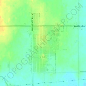
Name: Buhler topographic map, elevation, terrain.
Location: Buhler, Reno County, Kansas, United States (38.12991 -97.77782 38.14883 -97.76212)
Average elevation: 1,483 ft
Minimum elevation: 1,450 ft
Maximum elevation: 1,529 ft
Other topographic maps
Click on a map to view its topography, its elevation and its terrain.
Partridge
United States > Kansas > Reno County
Partridge, Reno County, Kansas, United States
Average elevation: 1,614 ft
Hutchinson
United States > Kansas > Reno County
Hutchinson, Reno County, Kansas, 67504, United States
Average elevation: 1,545 ft
Hutchinson
United States > Kansas > Reno County > Hutchinson
Hutchinson, Reno County, Kansas, 67504, United States
Average elevation: 1,555 ft