
Saunderstown topographic map
Interactive map
Click on the map to display elevation.
About this map
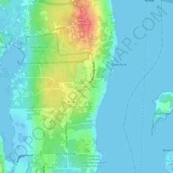
Name: Saunderstown topographic map, elevation, terrain.
Average elevation: 46 ft
Minimum elevation: -13 ft
Maximum elevation: 217 ft
Other topographic maps
Click on a map to view its topography, its elevation and its terrain.
Wickford
United States > Rhode Island > South County > North Kingstown > Wickford
Wickford, North Kingstown, South County, Rhode Island, 02852, United States
Average elevation: 39 ft