
Dolisie topographic map
Interactive map
Click on the map to display elevation.
About this map
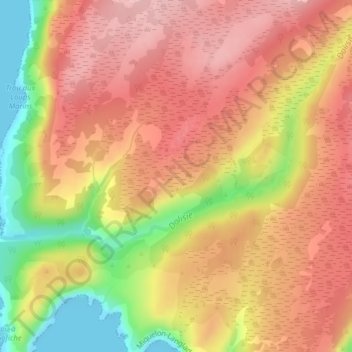
Name: Dolisie topographic map, elevation, terrain.
Average elevation: 344 ft
Minimum elevation: 0 ft
Maximum elevation: 551 ft
Other topographic maps
Click on a map to view its topography, its elevation and its terrain.
Grand Étang
France > Saint-Pierre-et-Miquelon > Miquelon-Langlade
Grand Étang, Rue Saint-Pierre, Miquelon-Langlade, Saint-Pierre-et-Miquelon, 97500, France
Average elevation: 36 ft