
Glenelg topographic map
Interactive map
Click on the map to display elevation.
About this map
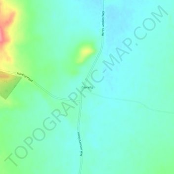
Name: Glenelg topographic map, elevation, terrain.
Location: Glenelg, Weddin Shire Council, New South Wales, Australia (-33.77389 148.06444 -33.73389 148.10444)
Average elevation: 951 ft
Minimum elevation: 889 ft
Maximum elevation: 1,165 ft