
Djerba topographic map
Interactive map
Click on the map to display elevation.
About this map
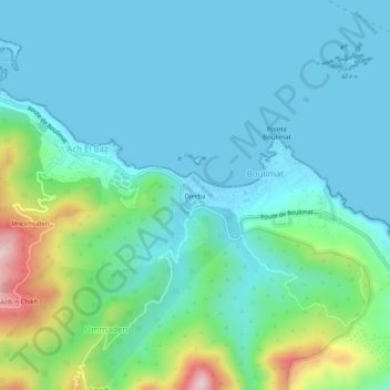
Name: Djerba topographic map, elevation, terrain.
Location: Djerba, Bejaia District, Bejaia, 06000, Algeria (36.79191 4.95794 36.83191 4.99794)
Average elevation: 279 ft
Minimum elevation: -3 ft
Maximum elevation: 1,398 ft