
La Fuentona topographic map
Interactive map
Click on the map to display elevation.
About this map
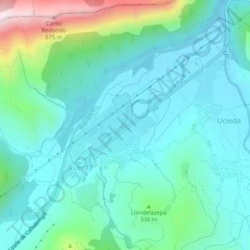
Name: La Fuentona topographic map, elevation, terrain.
Location: La Fuentona, Ruente, Saja-Nansa, Cantabria, 39513, España (43.26287 -4.26096 43.26362 -4.26067)
Average elevation: 863 ft
Minimum elevation: 515 ft
Maximum elevation: 2,221 ft
Other topographic maps
Click on a map to view its topography, its elevation and its terrain.