
T. O. Fuller State Park topographic map
Interactive map
Click on the map to display elevation.
About this map
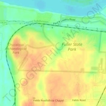
Name: T. O. Fuller State Park topographic map, elevation, terrain.
Average elevation: 256 ft
Minimum elevation: 184 ft
Maximum elevation: 315 ft
Other topographic maps
Click on a map to view its topography, its elevation and its terrain.
Lichterman Nature Center
Lichterman Nature Center, Hickory Way, Memphis, Shelby County, Tennessee, 38119, USA
Average elevation: 318 ft