
De Queen topographic map
Interactive map
Click on the map to display elevation.
About this map
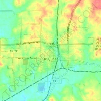
Name: De Queen topographic map, elevation, terrain.
Location: De Queen, Sevier County, Arkansas, 71832, United States (34.01973 -94.37370 34.06463 -94.30819)
Average elevation: 413 ft
Minimum elevation: 331 ft
Maximum elevation: 525 ft