
Ashland topographic map
Interactive map
Click on the map to display elevation.
About this map
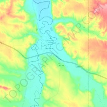
Name: Ashland topographic map, elevation, terrain.
Average elevation: 3,084 ft
Minimum elevation: 2,884 ft
Maximum elevation: 3,409 ft
The area offers a variety of topography, varying from rolling grasslands to steep rock outcrops. Vegetation varies from prairie to dense stands of ponderosa pine.