
Oldtown topographic map
Interactive map
Click on the map to display elevation.
About this map
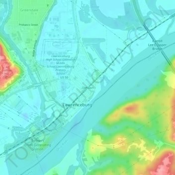
Name: Oldtown topographic map, elevation, terrain.
Average elevation: 512 ft
Minimum elevation: 440 ft
Maximum elevation: 784 ft
Other topographic maps
Click on a map to view its topography, its elevation and its terrain.
Upland
United States > Indiana > Dearborn County > Lawrenceburg
Upland, Lawrenceburg, Lawrenceburg Township, Dearborn County, Indiana, 47025, United States
Average elevation: 719 ft