
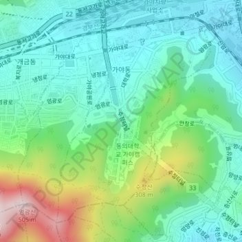
Gaya-dong topographic map
Interactive map
Click on the map to display elevation.
About this map
Name: Gaya-dong topographic map, elevation, terrain.
Location: Gaya-dong, Busan, Busanjin-gu, South Korea (35.13467 129.02022 35.15742 129.04649)
Average elevation: 449 ft
Minimum elevation: 26 ft
Maximum elevation: 1,565 ft